The Naviterier navigation will help the visually impaired get oriented on streets
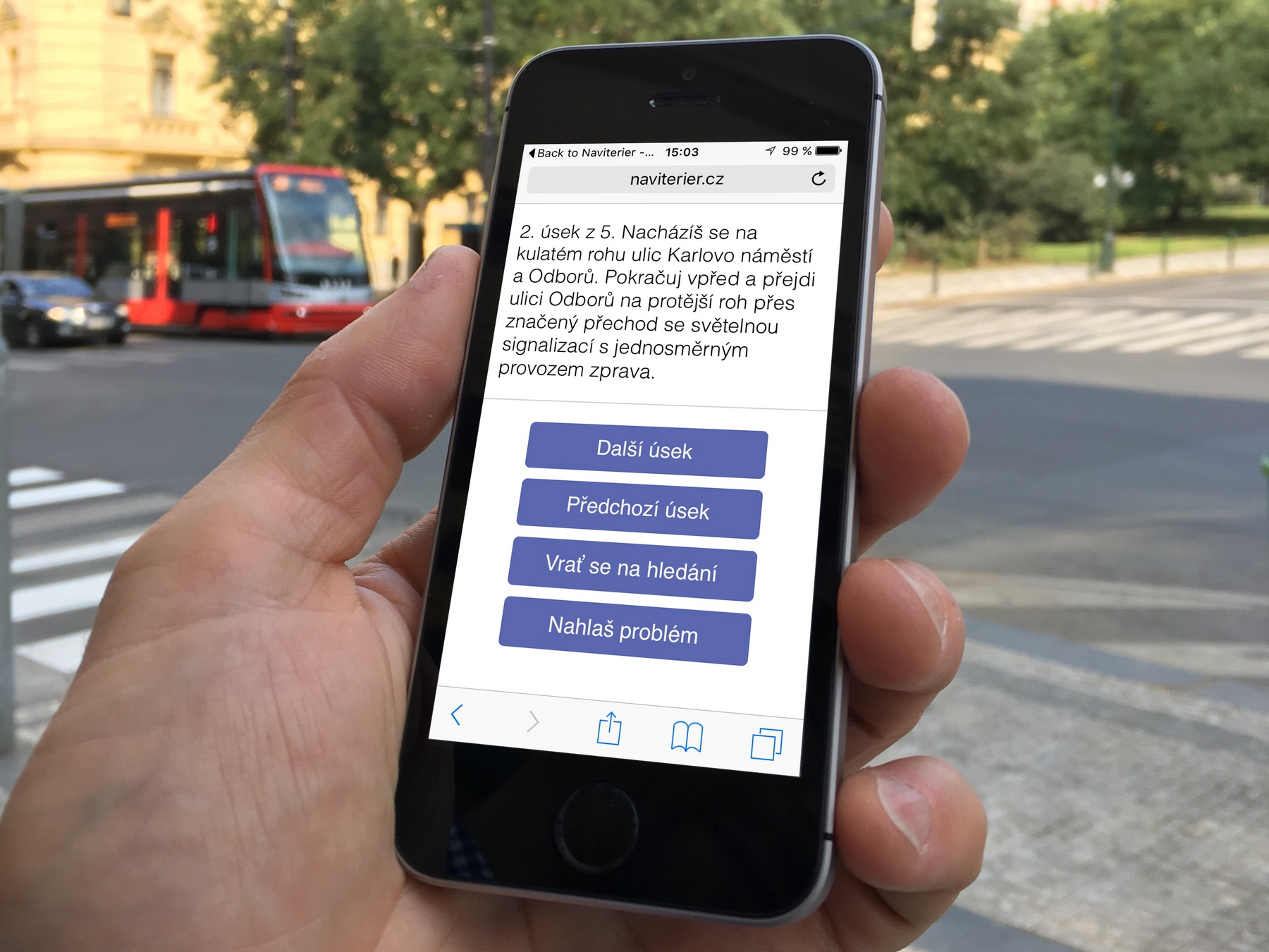
Thanks to the long-term development at the Faculty of Electrical Engineering´s Department of Computer Graphics and Interaction, Naviterier, a unique navigation application for the blind, was created. Its main authors are Zdeněk Míkovec and Jan Balata. The navigation uses the accurately mapped documentation of the ROUTE4ALL project. The blind is informed, for example, about the shapes of the corners of the streets or the slope and width of the pavement. The application will be available for download in the summer of 2017, but can now be pre-ordered on the web. Those who register before the end of April will have Naviterier free for half a year.
Naviterier will enable people with visual impairment to move around the city safely. Its main advantage is that it is the only one who plans a path along the sidewalks and describes it as human would. Navigation will be available in two versions - the Naviterier Routeplanner web application and Naviterier Conversation mobile application. The main advantage of the mobile version is the ability to create route lists, optimize for user needs, or GPS positioning. In the future, Naviterier will also be connected to the SONS Navigation Center, whose experts are constantly consulted on the development of the Naviterier.
More detail about Naviterier navigation can be found at: http://naviterier.cz/